PVX.Cad
Terrain-aware solar design,
inside AutoCAD
PVX.Cad is the main design and engineering application of the PVX.AI platform. It installs as a native plugin inside AutoCAD 2021 through 2027 and covers the full utility-scale workflow: terrain analysis, grading, terrain-aware layout, electrical design, battery storage, and construction-ready outputs.
Last updated:
 Runs inside
  Exports to
 Step 1 of 6
Terrain & Site Intelligence
Import KML, drone LAS/LAZ, CSV, or contours into AutoCAD from whatever source your site data exists in. PVX.Cad analyzes hydrology, soil compaction, and directional slopes before you place a single rack, so drainage, soil, and slope risks surface before they reach the field.
Learn more →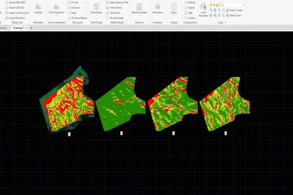
Step 2 of 6
Grading & Earthworks
Balance cut and fill with a ratio slider, or cap fill height for a hard ceiling. Pile-adapted grading regrades only the ground under the tables that need it, leaving the rest of the site untouched. On one project, comparing three grading approaches cut earthwork volume 70% and saved $727K.
Learn more →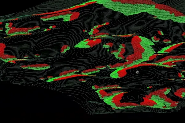
Step 3 of 6
Layout & Racking
Place fixed, East-West, and tracker racks, including terrain-following trackers that bend at joints to follow rolling or steep ground. Dynamic Pitch adjusts row spacing to sun position, Capacity Iteration sweeps spacing and tilt against a capacity target, and Design Wizard builds a full concept layout in one pass.
Learn more →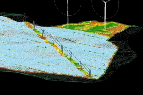
Step 4 of 6
Electrical Design
A five-step flow strings racks, scopes the design, configures the transformer and inverter hierarchy, places devices, and cables the plant. Stringing presets and PVsyst string-sizing checks catch errors early, cables size to a voltage-drop target, and the finished design exports as an IEC-60617 single line diagram.
Learn more →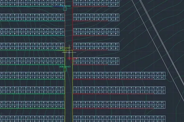
Step 5 of 6
Battery Storage (BESS)
Place battery containers with code-aware checks against NFPA 855 and IFC rules, alongside a PV plant or standalone. Augmentation planning reserves pads for future capacity, and pads get grading, fire lanes, and site noise contours. The code engine advises placement; compliance sign-off remains with your engineer of record.
Learn more →Step 6 of 6
Exports & PVsyst
Import modules and inverters from PVsyst PAN and OND files, then export finished designs as PVCollada, including PVC 2.0 with the full electrical hierarchy. Construction teams get a four-sheet Bill of Quantities, a pile coordinate and procurement optimizer workbook, Google Earth KML, and a one-click web publish link.
Learn more →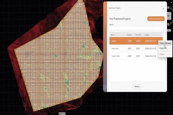
What does PVX.Cad run on?
- Runs inside AutoCAD 2021 through 2027, with automatic version detection
- Installs per user, no administrator rights required
- Five interface languages: English, Turkish, German, Italian, Spanish
- Works in metric and imperial drawings
- Guided onboarding tour for your first design
- In-app AI assistant and one-click bug reporting
- Licensing and updates through id.pvx.ai, activation bound to your machine
What PVX.Cad delivers
Design complete? Choose the next output.
PVX.View and PVX.Assess both begin with the completed PVX.Cad project, but they serve different jobs.
PVX.View
Publish an interactive 3D view
Create a shareable browser link with terrain, equipment, point-cloud display, sun and shadow simulation, heatmaps, and recorded flyovers. No AutoCAD installation is required for the people opening the link.
Explore PVX.View →PVX.Assess
Queue a comprehensive assessment
Submit the completed project for risk assessment, P50/P90 yield, BESS results, and financial analysis in one PDF. The queued cloud job can take up to 30 minutes to generate.
Explore PVX.Assess →Show the finished design without opening AutoCAD
PVX.View gives developers, investors, and construction teams an interactive Three.js view of the PVX.Cad project in any browser, including sun and shadow simulation, terrain display, and recorded flyovers.
See the browser viewer →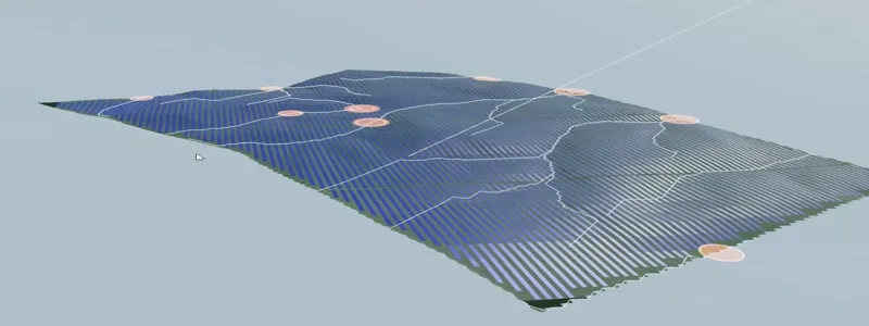
Frequently asked questions
What does PVX.Cad run on?
PVX.Cad runs inside AutoCAD 2021 through 2027, installs per user with no administrator rights, and is available in five languages: English, Turkish, German, Italian, and Spanish. It works in both metric and imperial drawings.
Does PVX.Cad design battery storage?
Yes. PVX.Cad includes a full BESS designer: code-aware container placement against NFPA 855 and IFC rules, augmentation planning, pad grading, fire lanes, and noise contours, alongside PV or standalone.
Does PVX.Cad support trackers on rolling terrain?
Yes. It supports fixed, East-West, single and multi-row trackers, and terrain-following trackers that articulate at joints to follow the ground.
Does PVX.Cad replace PVsyst?
No. PVsyst is the industry standard for yield simulation. PVX.Cad designs and exports clean PVCollada and PVsyst-compatible files with correct orientation.
What does PVX.Cad export?
DWG/DXF, PVCollada 1.x and PVC 2.0, PVsyst terrain CSV, a four-sheet Bill of Quantities, pile coordinates and a procurement optimizer workbook, Google Earth KML, and a shareable web viewer link.
How do PVX.View and PVX.Assess connect to PVX.Cad?
PVX.Cad is the main design application. When the engineering is complete, publish the project to PVX.View for browser-based 3D and shadow review, or submit it to PVX.Assess as a queued cloud job for a comprehensive PDF assessment generated in up to 30 minutes.
See PVX.Cad on your terrain file
Book a 30-minute live demo with grading analysis, layout optimization, and cable routing.